Lorenzo Dow Baker was the Wellfleet sea captain whose banana shipping business later grew into the United Fruit Company. He also chaired the committee that laid the groundwork for damming the Herring River. As the Provincetown Independent recounted this fall, one argument for the dike was getting rid of the mosquitoes that bothered guests at his Chequessett Inn. Town meeting approved the plan in 1908. The mosquitoes stayed.
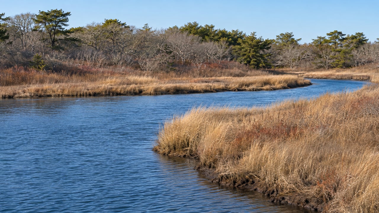
The dike went up in 1909 and has held back the tide ever since. Behind it, the salt marsh slowly turned into freshwater marsh, then meadow, and in places upland forest. This winter, the tide is scheduled to start coming back. Under the gate plan, the water rises in steps, with at least one full lunar cycle between each step, so the river behind Chequessett Neck Road should look a little different each month between now and spring.
What now sits under Chequessett Neck Road
You can drive across the new Chequessett Neck Road Bridge now. MIG Corp. of Acton removed the temporary bypass bridge in mid-August. That bypass had been carrying traffic since March 2024. The Independent reported that paving and a guardrail were still to come. The bridge cost roughly $32 million, paid for by the U.S. Department of Agriculture and the Massachusetts Division of Ecological Restoration. It is one part of the $70 million first phase of the Herring River Restoration Project.
The old crossing pushed the whole river through three culverts, each six feet wide. The Cape Cod National Seashore describes the new bridge as 165 feet wide. It has 17 adjustable gates, and they do different jobs:
- Ten sliding gates do most of the work. They can be raised and lowered with generator power or by turning a wheel below each one by hand.
- Five of those ten can also open as flaps. That lets more water drain out of the river without raising the high tide.
- Seven stop gates sit closer to the shore. They are fixed panels that can be removed, and project representative Wes Stinson of Apex Environmental Partners told the Independent they "won't be the primary gates we modify the flow with."
A row of clear plastic tubes stands behind the viewing area on the harbor side. Those tubes protect the stems of the ten sliding gates. Above them is a line of wheels, pointing up. The generator that runs the gates is kept at the DPW on West Main Street.
Two more pieces were being built in October. One is a set of portage stairs on the upstream side, so paddlers can carry canoes and kayaks over the bridge, since boats can't pass through the gates. The other is a boardwalk to a small parking area at the bridge's northeast corner. Stinson estimated both would be done by the end of the year.
The tide comes back one moon at a time
The Herring River Executive Council runs the project. It includes representatives of the National Seashore and the Wellfleet Selectboard. The council's October 1, 2026 meeting packet sets out the opening plan in this order:
- The gates start at the old tide condition, which is the water level the dike allowed.
- During fall 2026 through spring 2027, the gates open in increments toward a mean high water of 1.8 feet in the Lower Herring River.
- Each increase is followed by at least one full lunar cycle before the next.
- Once the river reaches about 1.8 feet, the gates hold there for 24 months, and monitoring continues the whole time.
The 1.8-foot mark is the level at which tides spill over the stream and creek banks and flood the marsh surface. At its July 15 meeting, the council adopted a policy that sets this as the target for the end of the first year. That would restore tide to about 222 acres, 39 percent of the 570 acres in the project's first phase, which was permitted in 2023.
Stinson summed up the approach to the Independent in late September:
"We'll incrementally increase the amount of water coming into the system and monitor and observe what's happening."
There is a reason for the slow pace. According to the National Seashore, the marsh surface upstream of the old dike sits about 70 centimeters, a little over two feet, lower than the natural marsh just downstream. A century of drainage dried out the peat, and it sank as it shrank. If seawater came back too fast, some of that sunken ground would end up too low to grow salt marsh grass. Opening in increments lets the project see how each part of the river responds before it adds more water.
Why Bound Brook Island Road closes the same winter
The tide will eventually reach places it hasn't reached in a hundred years, so the roads along the edge of the floodplain have to be ready first. That work is why Bound Brook Island Road closed on November 16.
Under the Town of Wellfleet's Low Lying Roads Project notice, N & M Construction is installing culvert #2 along the Herring River. Through the work zone, no cars, bikes, or pedestrians can pass. The town estimates the detour will last through early March 2027. Until then:
- Heading south, take Pamet Point Road.
- Heading north, take Coles Neck Road.
- If you live on Bound Brook Island, come in from the north by Pamet Point Road.
- For the transfer station, it is open Friday through Tuesday and closed Wednesday and Thursday, a schedule the town set in August.
The closure is the latest step in a road program that has been underway all year. The town's culvert and road work began January 16, 2026, and Friends of Herring River expects it to continue through much of 2027. Weekly updates go up on the town's News & Updates page. According to the National Seashore's October update, here is what has changed so far:
- The Pole Dike Road crossing by the transfer station has been raised about four feet. A new box culvert, eight feet high, replaced the old 36-inch pipe.
- Just under a mile of Bound Brook Road has been raised, most of it by three to four feet, between the transfer station and Pamet Point Road. The small culvert near the Atwood-Higgins property is next.
- Five short segments of Old County Road have been raised. Three of them are in Truro.
- In July 2026, crews removed the five-foot culvert at the end of High Toss Road. The stretch between Hopkins Drive and Pole Dike Road was not raised and may be wet and impassable at some tides.
The Pole Dike Road gate is managed by the town. For now it lets only freshwater flow downstream, and no tidal water will move upstream of the road until agreements with affected landowners are finalized. So the first returning tides will show up in the Lower Herring River near Chequessett Neck long before they reach the upper creeks.
What the bridge shows as the season turns
The viewing area faces Wellfleet Harbor. On one side of the bridge is open bay, and on the other is a river that has run on a restricted tide since 1909. If you walk out at the top of a tide every few weeks this winter, you'll be watching the plan happen in real time. The gate stems in their clear tubes will move as each step is made. The clearest sign of progress will be at the 1.8-foot mark, when high water starts to top the creek banks and spread over the marsh.
Other changes upstream are part of the same plan. Work to control about 15 to 20 acres of invasive common reed, the tall Phragmites, in the Lower Herring River was set to start in fall 2026. Vegetation clearing around Duck Harbor is finished for the year. Two small pilot projects are also planned to rebuild sunken marsh. At Duck Harbor, the "Berm" project will remove spoil piles left from mosquito-control ditching in the 1920s and use some of that material to build up nearby marsh. At the mouth of Mill Creek, a "thin layer placement" project will add local sand, a sand and limestone mix, or a sand and olivine mix to three test plots and track how each one does.
About 500 yards upstream, the Mill Creek water control structure was finished in September 2025. It spans roughly 520 feet, with five five-foot openings fitted with their own adjustable gates. They can close against incoming tide and still let freshwater drain out.
The National Seashore expects salt to kill off many of the non-native plants that have spread across the floodplain and to make room for salt marsh plants to come back. It also expects river herring to return to spawn in Herring, Higgins, and Gull Ponds, where the watershed begins. None of that happens in one winter. The first steps toward it do, and you can see them from the bridge on Chequessett Neck Road.
At Christie's International Real Estate Atlantic Brokerage, we follow projects like this one because they change how Wellfleet looks and how its roads work, from the bridge to Bound Brook Island. If you own along the Herring River corridor or are thinking about what this work means for a Wellfleet property, we welcome you to Request a Private Market Consultation with our Wellfleet team.